
This newsletter drop summarizes a few of my favorite locations, trails, and campsites in the Ouachita National Forest. If you follow the YouTube channel, this will likely answer any questions you have about locations, Trail/camp conditions, and points of interest within my Ouachita videos. If you are not a subscriber but are planning a trip this will provide a good starting point and inspiration.
Destination
~The Eagles Nest Campsite
This campsite is nestled above Broken Bow lake. It offers an expansive view of the lake and the rolling hills for miles upon miles.

Eagles Nest view
Campsite Location
~This spot is on a ridge overlooking the lake. It’s about a seven mile trip down some gravel forest roads. It being a popular spot means that the journey there can be fruitless as other campers may have claimed it. Additionally, there aren’t really any other campsites nearby, but it’s always worth a try. During good weather and holidays I would make claim of this spot earlier in the day for the best chance to camp there.
Campsite coordinates: 34.27269, -94.70115
Campsite accessibility
~ It’s a bumpy gravel road but there isn’t anything very technical. I would say any vehicle could make it here. Deflating your tires isn’t a bad idea and will make the drive more enjoyable.

Rolling hills of Broken Bow
Route to campsite
~ To get to this spot you take highway 259 to the northern end of Broken bow lake. Turn onto forest road 54000 and drive on that all the way to a four way stop. Then head straight onto forest road 54256 and then take a right onto forest road 54262 which goes all the way to the spot.
Destination
~The Kiamichi Trail
This trail is located about an hour north of Broken Bow Oklahoma. It offers some challenging terrain that can take hours to traverse. This trail is a full days work if you want to complete it in one shot. My full size truck had no problem finishing this trail, but I would definitely recommend four wheel drive to complete the journey.

K-Trail from the drivers seat
Trail Location
~Again, this trail is about an hour north from Broken Bow. I would recommend starting at the trail head near the three sticks monument. This offers a good place to air down and prepare for hours of trail riding on rocky terrain. Also if you take the trail west from the monument it will take you to a cool fire watch tower, more on that later.
Trail coordinates: 34.61288, -94.65724
Trail conditions
~ This trail is doable by a stock four wheel drive vehicle, but you can expect to get many scrapes from rocks and also a lot of pin stripes from trees and branches that engulf the sides of the trail.

Eastern Redbuds awaiting to apply fresh pin stripes to my truck
There are sparse campsites along the trail that can be used as halfway points if you want to split the trail up. Which I would recommend because if not it’s a really long day. Besides for the almost constant rock gardens there are a few ledges to be handled, they aren’t anything to fear but are a welcomed obstacle to break up the rocks.

Negotiating the rock ledges
Trail summary
~ If you are looking for an easy quick trail to do this is not it, but if you want a challenge for you and your rig and have at least a day to commit I recommend at least doing it once. Again, any stock 4 wheel drive vehicle can do this trail but you will get some bumps and bruises.
Destination
~The kiamichi lookout tower
The lookout tower is located at the westernmost part of the K-trail. If you go any further past it you will be encroaching on private land. This is a perfect point of interest to explore because it has a decently fun and challenging trail to get there. It took us about an hour to traverse it one way. Once you make it to the tower you can spend some time to explore the structures and make a quick snack before heading out. There are no real campsites along the trail.

K-Trail lookout tower
Tower Location
~To get to this tower you have to traverse about an hour of trail. The start of the trail is located right by three sticks monument.
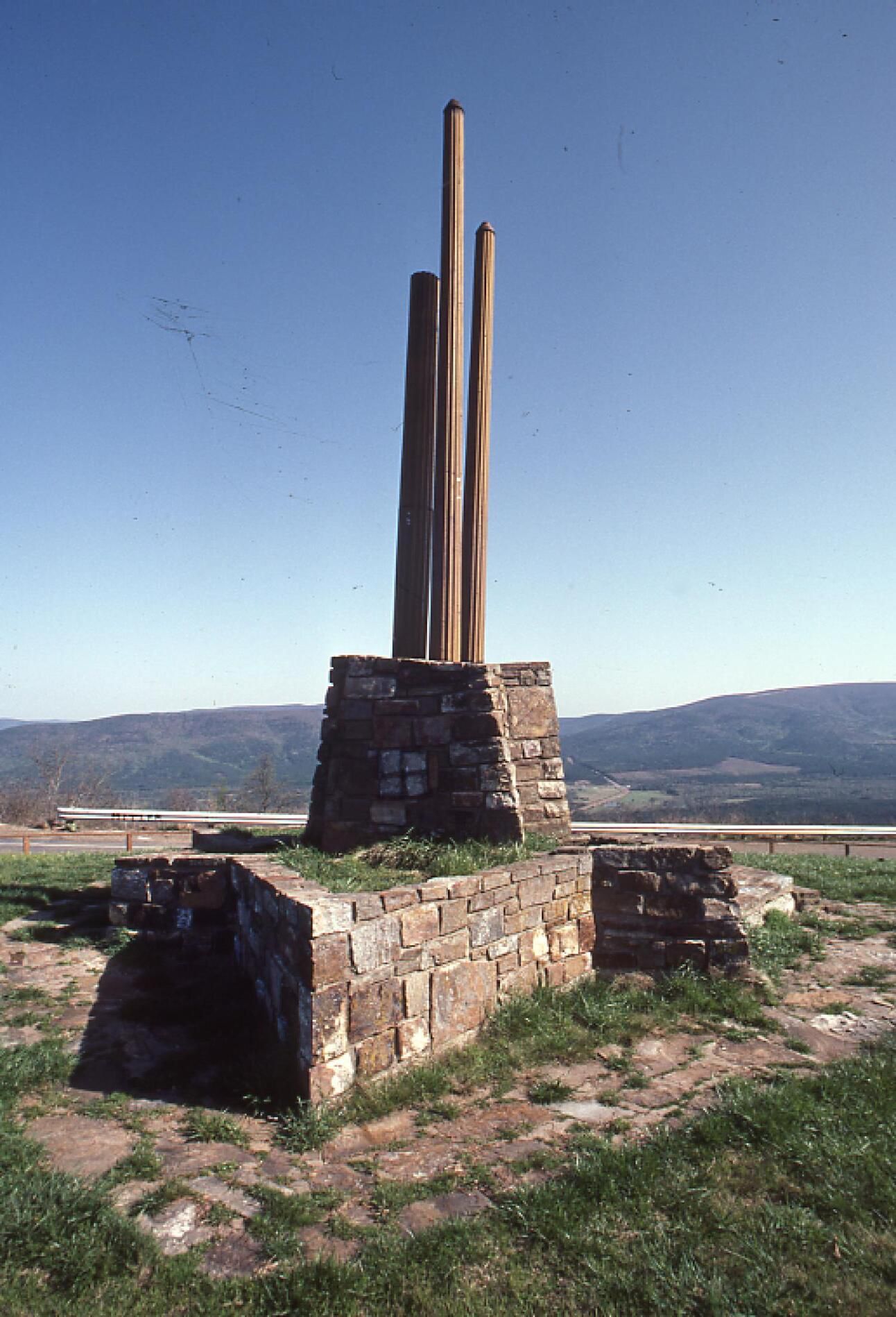
Three sticks monument
Three sticks coordinates: 34.61263, -94.65755
Trail conditions
~ As I mentioned earlier the trail to the tower is about an hour of rocky, muddy, and bumpy driving. A stock four wheel drive vehicle is needed and even then some scraping will probably happen.
Tower History
~ The tower was originally constructed in 1927 for the Oklahoma forestry service. It was one of twenty three towers once operated by the forestry service, now only the condemned tower, celler, and some building foundations remain.


Kiamichi fire tower

Birds eye view of tower
Scripture of the month:
Jesus replied: “Love the Lord your God with all your heart and with all your soul and with all your mind.” This is the first and greatest commandment. And the second is like it: “Love your neighbor as yourself.”
Matthew 22:37-39
Link to videos below: